OVERVIEW
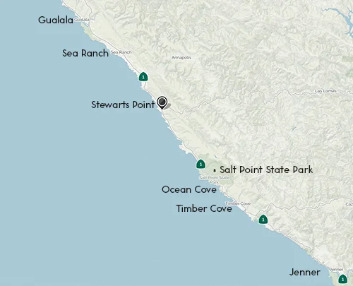
Stewarts Point Map
Stewarts Point is a hamlet perched on a bluff overlooking the rugged Sonoma Coast. It is 110 miles northwest of San Francisco and just south of Sea Ranch and a 45 minute drive from Jenner on Highway 1.
The new Kashia Coastal Preserve abuts Salt Point State Park’s northern edge about three miles south of Stewarts Point. It straddles Highway 1, with about 52 acres of coastal prairie on the west side and 636 acres on the inland side long used for cattle grazing and timberland. Approximately 600 acres of coniferous forest off-limits to most commercial logging, prevents any future development on the site and contributes more than a mile to the planned California Coastal Trail, a 1,200-mile path ultimately intended to connect Mexico to the Oregon border. The recent land sale was initiated by members of the Richardson family, which has owned much of the oceanfront property in the Stewarts Point area for generations, since Herbert Archer Richardson first arrived from New Hampshire, in 1876 with a new bride and 40 cents in his pocket.
There is Stewart Point post office that the Richardson family has a long history as its postmasters.
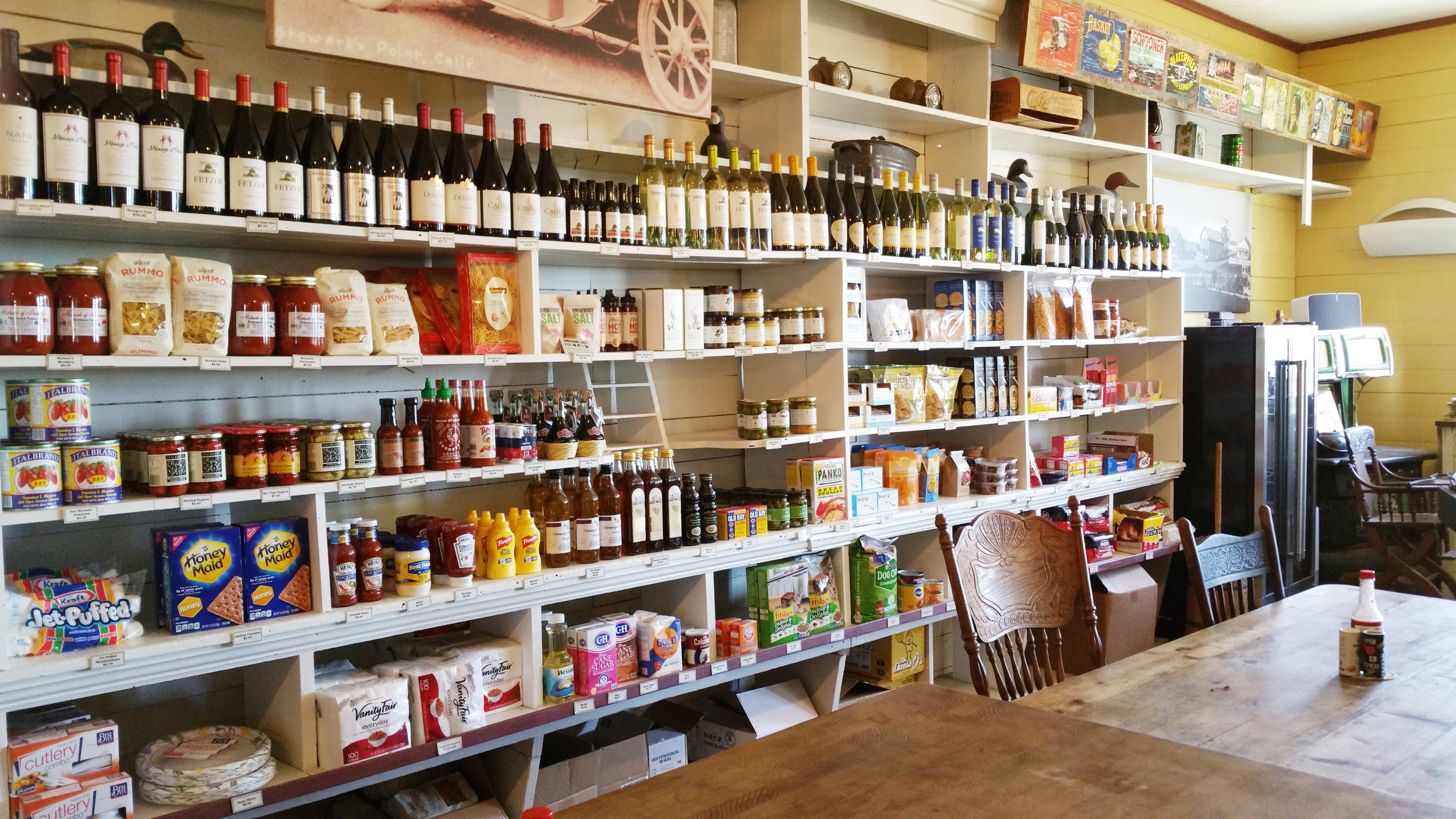
The 122 year old Stewarts Point General Store was owned and operated by the Richardson family since it was built in 1868. In the store they had a variety of Richardson family heirlooms, like the 1888 baby buggy, a 160-year-old wheelbarrow, and turn-of-the-century fish traps, horse collars and oxen yoke.
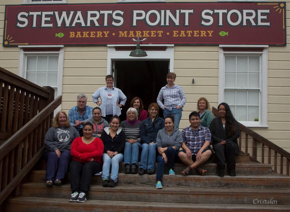
Twofish Baking Company's Stewart Point Store
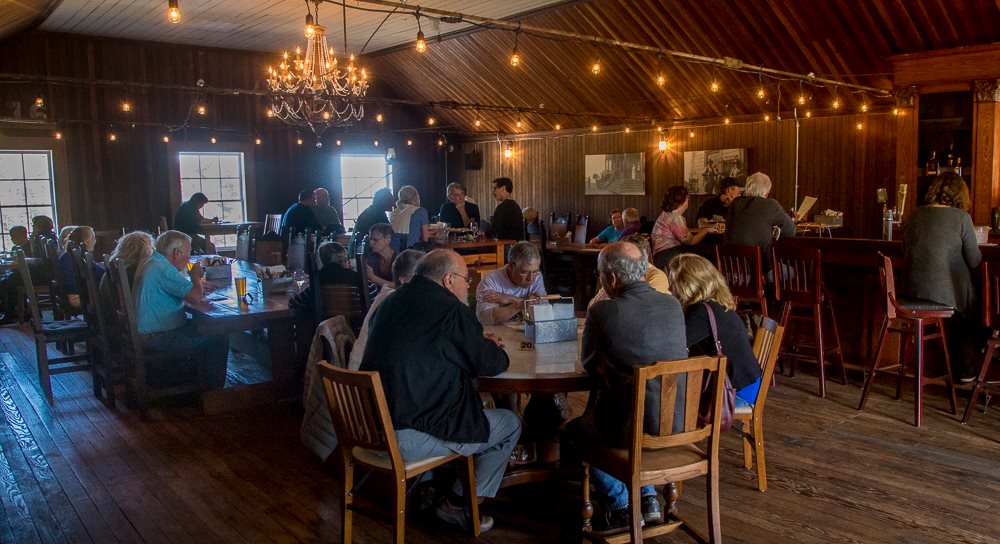
BAKERY
Our bakery is now inside the historic Stewart's Point Store. Hand made goodies and fresh bread each day. Wonderful coffee and espresso drinks!
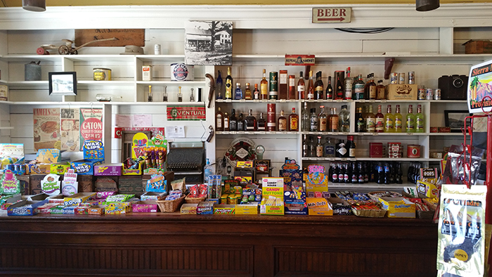
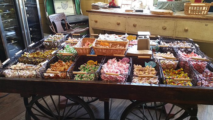
MARKET
Find that candy you haven't seen since you were a kid. A gift to take home from a local artist. Grab some wine or beer to take to your picnic. You just never know what kind of treasure you'll discover on our ever changing shelves.
EATERY
Breakfast burritos, sandwiches on house made bread. soups from scratch. wonderful calzones and salads. Delicious meats from our smoker. Fossilman's soft serve ice cream for dessert (or just because)! Oh, don't forget the "Twofish Tiny Tap Room" for a cold draft beer!
HOURS
Open Wed. thru Sunday 7:30-3:30
Twofish Baking Company's Facebook Page
Coastal Living Magazine
We are lucky enough to be a part of a great article in the Coastal Living Magazine! Check it out: https://www.coastalliving.com/travel/california/california-sonoma-county
Thanksgiving Dinner To Go
Here is the menu for Thanksgiving Dinner To Go. Because of a smaller crew and increasingly questionable logistics, we are asking our friends and customers to order as early as possible. We are literally afraid that we may not be able to get the raw materials necessary to produce the meal if we wait until the last minute to put in our order with our suppliers. Shortness of staffing seriously compounds the potential problem. We also ask that you phone your order in to one of our staff rather than dropping an email or a message. (With fewer staff, we just can not manage the confusion that is often generated by email and messaging.) We very much want to serve as many of our wonderful friends and customers as possible and we want to make your Thanksgiving Dinner as delicious as possible. Thank you in advance for understanding.

Nearby Beaches
Black Point Beach, 2.5 miles away, NW
Black Point Beach is a public beach located in the Sea Ranch community.
Horseshoe Cove, 2.8 miles away, SE
Horseshoe Cove Beach is a remote rocky beach near the northern boundary of Salt Point State Park.
Pebble Beach, 3.4 miles away, NW
Pebble Beach is in the housing community of Sea Ranch and gets it’s name from the dark pebbly sand.
Fish Mill Cove, 4.1 miles away, SE
Fisk Mill Cove Beach is a rocky beach in Salt Point State Park in Sonoma County.
Stengel Beach, 4.8 miles away, NW
Stengel Beach is a northern Sonoma County public beach located in the private community of Sea Ranch.
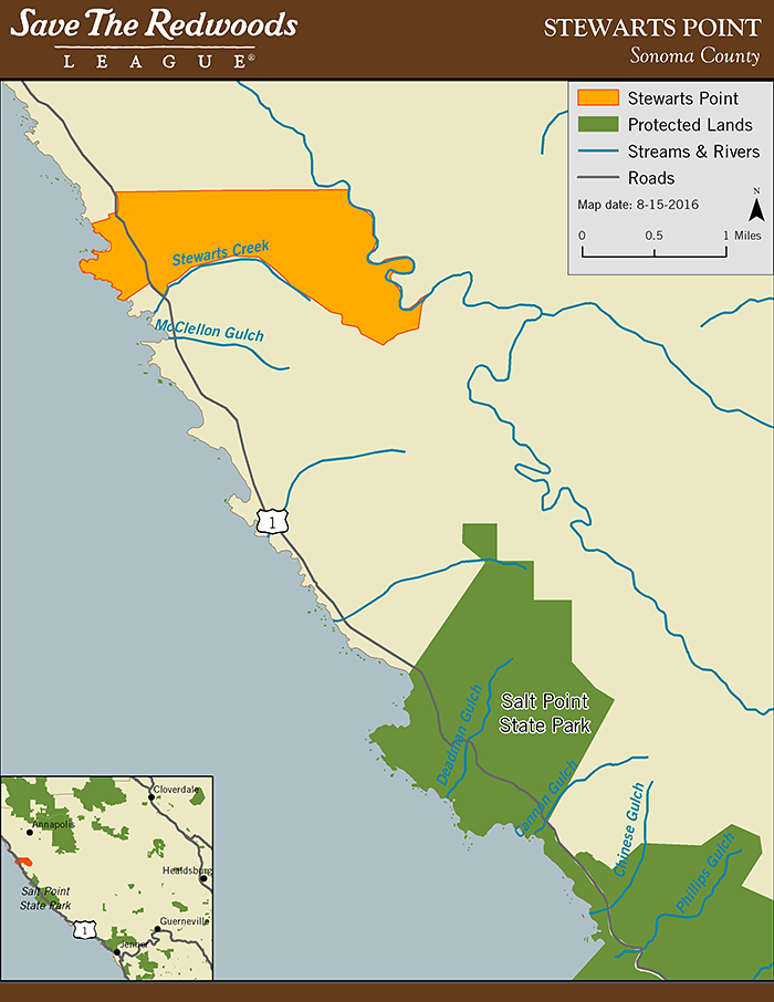
Creating the Forest of the Future
Extending inland from the coastal bluffs for about 2 miles to the South Fork Gualala River, 700 acres of the Stewarts Point property is blanketed in a healthy second-growth coast redwood forest with scattered old redwoods, Douglas-fir, bishop pine, and a variety of hardwoods. It’s also home to two sag ponds created by the San Andreas Fault. On its eastern edge, the property winds along approximately 1.7 miles of the steelhead-bearing Gualala River. Thousands of acres of sustainably managed private forestland surround the property, making it an important wildlife corridor.
Extending the California Coastal Trail
The Save the Redwoods League’s agreements with the County of Sonoma and the District ensure construction of a trail that will traverse the coastal terrace for just under 1 mile, and provide visitors with a gorgeous view of the coastline. The new trail will have a designated parking area along Highway 1, and both will be developed and managed by Sonoma County Regional Parks. When complete, the trail will connect with the California Coastal Trail network, which will ultimately extend 1,200 miles from Oregon to Mexico. The Stewarts Point trail segment will be open by the end of 2019 after planning is completed by Regional Parks.
https://www.savetheredwoods.org/project/stewarts-point-stewardship-project/
The lumber chute locations at Stewarts Point are indicated by the yellow pin. (Credit: Google Earth)
DOGHOLE PORT
Stewarts Point and the adjacent Fisherman Bay have a long and important history to the indigenous Pomo people who have lived in the area for millennia. The large sheltered cove fed by a small creek offered access to the area’s bountiful marine and coastal resources. The topographic advantages of this location were equally recognized by Euro-American settlers who set out from San Francisco to take advantage of the coastal redwood forest. John and Andrew Fisk built the first landing at Stewarts Point in 1867. By 1877, three lumber chutes shipped out products from nearby mills. Herbert Archer (H. A.) Richardson bought the property in 1881and used the middle chute, the only operational one by that time, until he built his own. Richardson’s lumbering activities were a family venture that continued on for 40 years until trucks replaced water shipment in 1925.
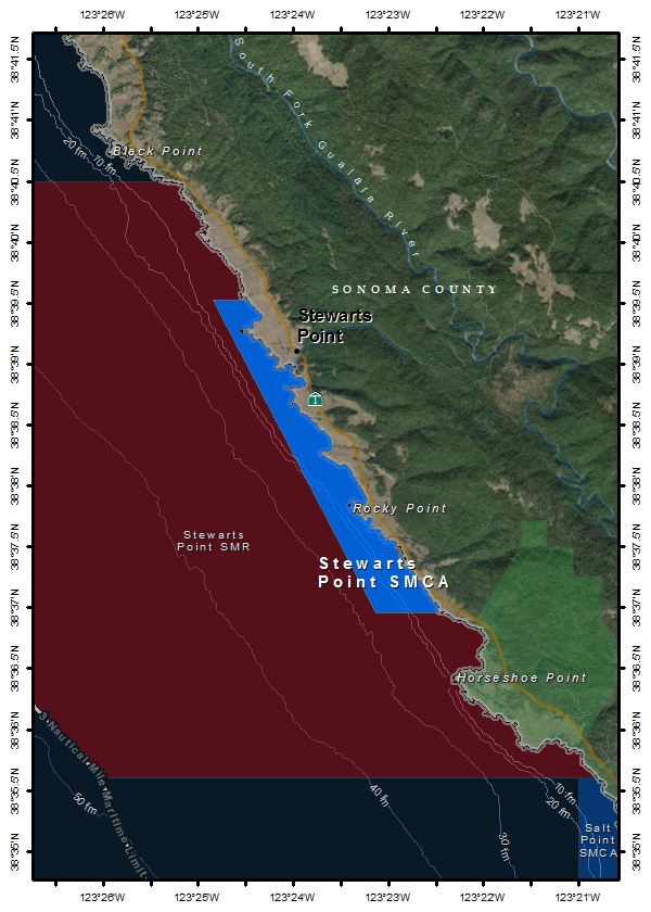
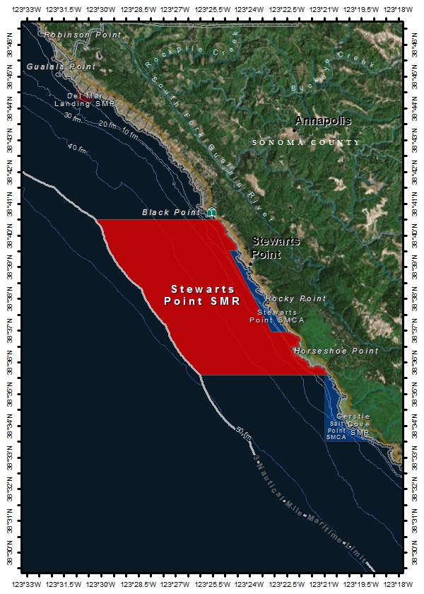
Link To North Central California Marine Protected Areas
State Marine Reserve (SMR)
An MPA designation that prohibits damage or take of all marine resources (living, geologic, or cultural) including recreational and commercial take.
Stewarts Point SMR Permitted/Prohibited Uses:
It is unlawful to injure, damage, take, or possess any living, geological, or cultural marine resource.
State Marine Conservation Area (SMCA)
An MPA designation that may allow some recreational and/or commercial take of marine resources (restrictions vary) .
Stewarts Point SMCA Permitted/Prohibited Uses:
It is unlawful to injure, damage, take, or possess any living, geological, or cultural marine resource for recreational and/or commercial purposes, with the following specified exceptions:
The following may be taken recreationally from shore only: marine aquatic plants other than sea palm, marine invertebrates, finfish by hook-and-line, surf smelt by beach net, and species authorized in Section 28.80 of these regulations by hand-held dip net.
"Tractors, Trains & Shipwrecks: Yesteryear Recollections of Sonoma County"
NEW BOOK by Donald R. Richardson (Author), Donna Richardson Robbins (Introduction)
The late Donald R. Richardson (1914 - 1983) was a member of one of Sonoma County's founding ranching families, the Richardson clan of Stewarts Point, CA -- a small unincorporated coastal hamlet located a few hours north of the Golden Gate Bridge.
A rancher and businessman, he was a committed steward of the land and actively involved in early environmentalism, providing agricultural leadership on a local and statewide basis in addition to serving as County Supervisor; he was a lifelong resident of Sonoma County.

He penned these recollections and colorful anecdotes of his late in his life, many set in the 1920's & 30s when he was growing up in an era very different from today.
The son of a schoolteacher, it was a dream of his to be an author one day -- and so it was the efforts of his daughter, Donna Richardson Robbins, who brought this book to fruition on his behalf...and in his memory.
These are his stories: firsthand exploits, oddities, and homespun yarns from his boyhood…and beyond. He penned these tales late in his life, and died in 1983.
This gift book is 8 1/4" x 8 1/4" square and also includes a historical map and colored design elements.
Learn more and order online.
Lodging
There are lodging options south and north of Stewarts Point. In the Timber Cove area you have the Timber Cove Resort and Fort Ross Lodge. In Ocean Cove the Ocean Cove Lodge and the Ocean Cove RV and Campgrounds. North of Stewarts Point the Sea Ranch Lodge and several options in Gualala. On the Sonoma coast Terra Glamping. A variety of vacation rentals can be rented through local companies and online.

BRIEF HISTORY
The first Richardson to own and operate the store was Herbert Archer Richardson, who arrived here from New Hampshire., in 1876.
He became a timber baron, and eventually purchased 25,000 acres, including eight miles of shoreline. He ran cattle and sheep and employed more than 300 lumberjacks cutting and processing redwood shipped out of Stewarts Point on his nine sailing vessels.
Lumber was hauled on the nine-mile Richardson Railroad to where the old store is located. Logs were carried the last half-mile to Richardson Harbor on rail cars mounted on wooden tracks. Brakemen gingerly guided the cars down a steep slope on a gravity run to the edge of the cliff.
From the cliff, the logs were loaded onto a chute and carried to the decks of lumber ships tied up at the Richardson Wharf. Oxen pulled the empty cars back up the steep slope.
In 1926, when Highway 1 was finally pushed through to Stewarts Point, the lumber ships were replaced by trucks. Lumbering activity slowed considerably during the Great Depression.
Bus Richardson, his father and his grandfather were postmasters at Stewarts Point from 1876 to 1984, when Ray Berleyoung, 52, who worked in the store for 30 years, became the postmaster.
The room above the store was a dance hall until the late 1940s. Across from the old store are two lichen-covered, bare-wood abandoned hotels built in the 1880s. This was also a stagecoach stop and the was also a one room school house.
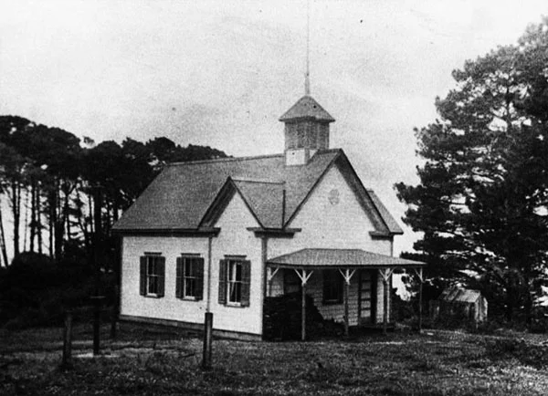
Building used as school from 1885-1944
CYCLING TOUR
This is a 52.67 mi Bike Ride in Stewarts Point, CA, United States. The Bike Ride has a total ascent of 6600.82 ft and has a maximum elevation of 1,592.29 ft.
http://www.mapmyride.com/us/guerneville-ca/salt-point-sp-loop-route-5567176
